Peeping below the ice - constraining runoff and sediment transport in northern rivers
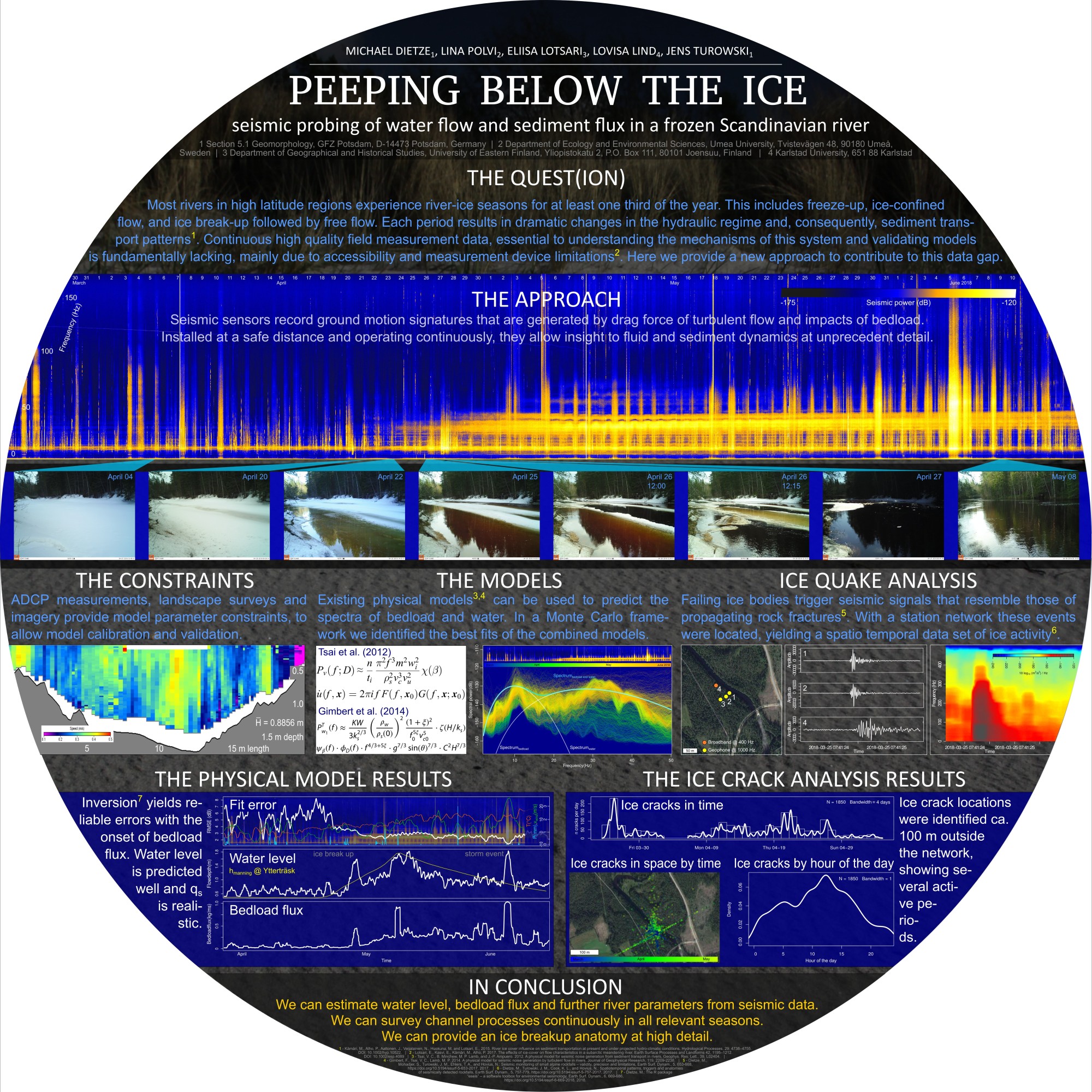
Most rivers in high latitude regions experience river-ice seasons for at least one third of the year, including freeze-up, a frozen period and break-up (Prowse and Beltaos, 2002). This effect results in dramatic changes in the hydraulic regime and, consequently, sediment transport patterns. In combination, these processes reshape the river cross section and length profile, with consequences from engineering and hazard mitigation perspectives. A major problem for gathering continuous high quality field data is that during four to seven months per year, when the surface of such rivers is frozen, it is difficult to get any direct continuous measurement data at all, except for tedious periodic probings through holes drilled through the ice. In particular, the sediment transport, river ice and flow data would be important to be observed continuously for detecting the wintertime processes in river channels. A new solution to this shortcoming is the inversion of the signals recorded by geophones and broadband seismometers for both hydraulic turbulence and bedload flux (see Project hydraulic unmixing).
In the Icy river project, we – Lina Polvi (Uni Umea), Eliisa Lotsari (Uni Eastern Finland), Lovisa Lind (Uni Karlstadt), jens Turowski (GFZ Potsdam) and I – probe the Saevaon, a river north of Umea, Sweden. We use multiple seismic sensors to tackle the above problem. We are able to detect the onset of ice break up and locate ice cracks during this phase. We are also able to continuously monitor the superimposed seismic signatures of water turbulence and bedload transport of sediment. Using a Monte Carlo approach we can unmix these two signals and invert the data for real world values of water runoff and sediment flux.
The research article (JGR-ES) has finally been accepted and is available online. The poster below gives an overall summary of the project. A larger version is available here.